Log in
All resources
Create a design
9,296 Free Artworks of Map Collection
bibliothèque nationale de france
statens museum for kunst
british library
prints by johan frederik clemens in the statens museum for kunst
johan frederik clemens
maps from gallica
guillaume sanson
copperplate print
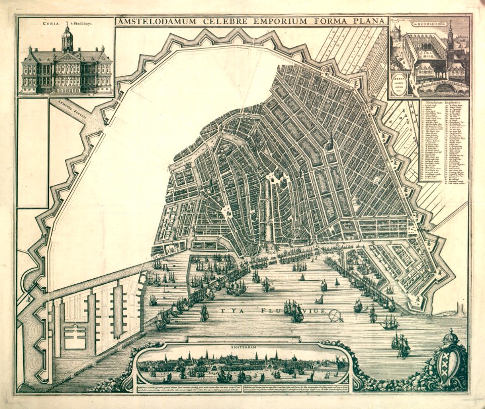
special collections of the university of amsterdam
maps by willem and johannes blaeu
maps from university of amsterdam special collections
atlas der neederlanden
theatre geographique du royaume de france (1632)
maps of provence by pierre-jean de bompar
maps of the dutch east india company - sri lanka
1787
map collection of leibniz-institut für länderkunde
1690s maps of the iberian peninsula
maps by willem and johannes blaeu
1640s maps of belgium
17th-century maps of nord (department)
maps of artois
maps of ancient italy by philipp clüver
old maps of the history of liguria
prints by johan frederik clemens in the statens museum for kunst
etching print
prints by johan frederik clemens in the statens museum for kunst
etching print
prints by johan frederik clemens in the statens museum for kunst
engraving
prints by johan frederik clemens in the statens museum for kunst
engraving
prints by johan frederik clemens in the statens museum for kunst
etching print
prints by johan frederik clemens in the statens museum for kunst
engraving
historical collections of the state of new jersey (1852)
maps of trenton, new jersey
eran laor cartographic collection
cornelis de bruyn
maps by joachim bormeester
1685 maps
carte des pays-bas catholiques by guillaume sanson
cartouches by sanson family
amaterasu ōmikami
ukiyo-e
drawings in the metropolitan museum of art
johannes brandenberg
drawings in the metropolitan museum of art
johannes brandenberg
old maps of switzerland
maps from gallica
1669 maps of south america
guillaume sanson
engravings in the yale center for british art
nathaniel whittock
19th-century maps of gabon
1877 maps of africa
pierre antoine tardieu
heinrich keller
old maps of switzerland
maps from gallica
maps of the south atlantic
guillaume dheulland
map of the upper rhenian circle by sanson
1680s maps of north rhine-westphalia
liber qvartvs contrafactur vnd beschreibung von den vornembsten stten der welt (zzk 0.32)
patrimonium 2 (project)
liber qvartvs contrafactur vnd beschreibung von den vornembsten stten der welt (zzk 0.32)
patrimonium 2 (project)
1660s maps of france
maps of lyonnais
maps in the british museum
baroque
paintings in the rijksmuseum amsterdam
han van meegeren
atlas sive cosmographicae (gerardus mercator, 1630)
maps of corsica by gerardus mercator
20th-century maps of oise
maps from gallica
atlas sive cosmographicae (gerardus mercator, 1630)
maps of england by gerardus mercator
plenilunii lumina austriaca philippica
maps from gallica
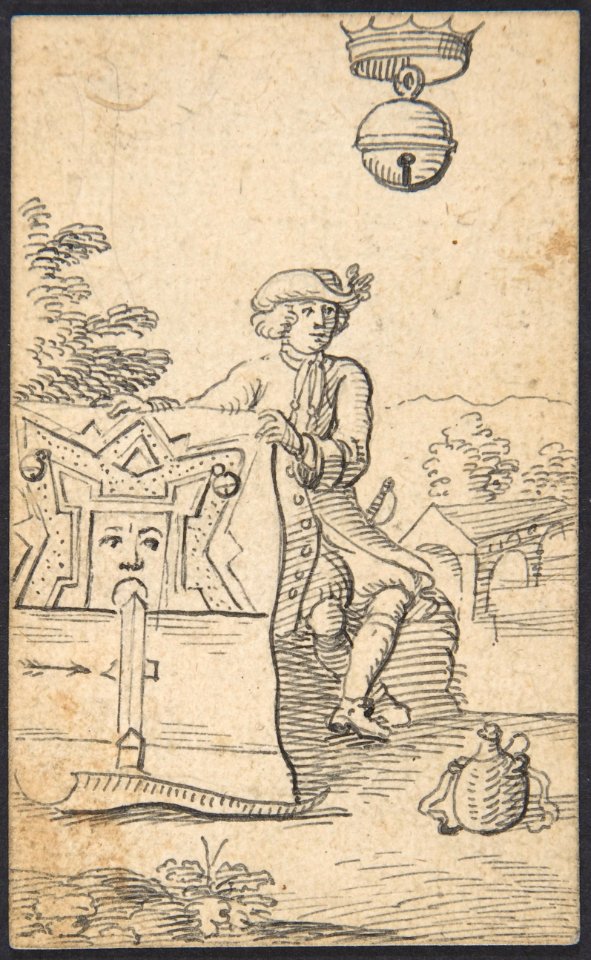
drawings of soldiers
jan anthonie coxie
early netherlandish painting,northern renaissance
the garden of earthly delights, closed
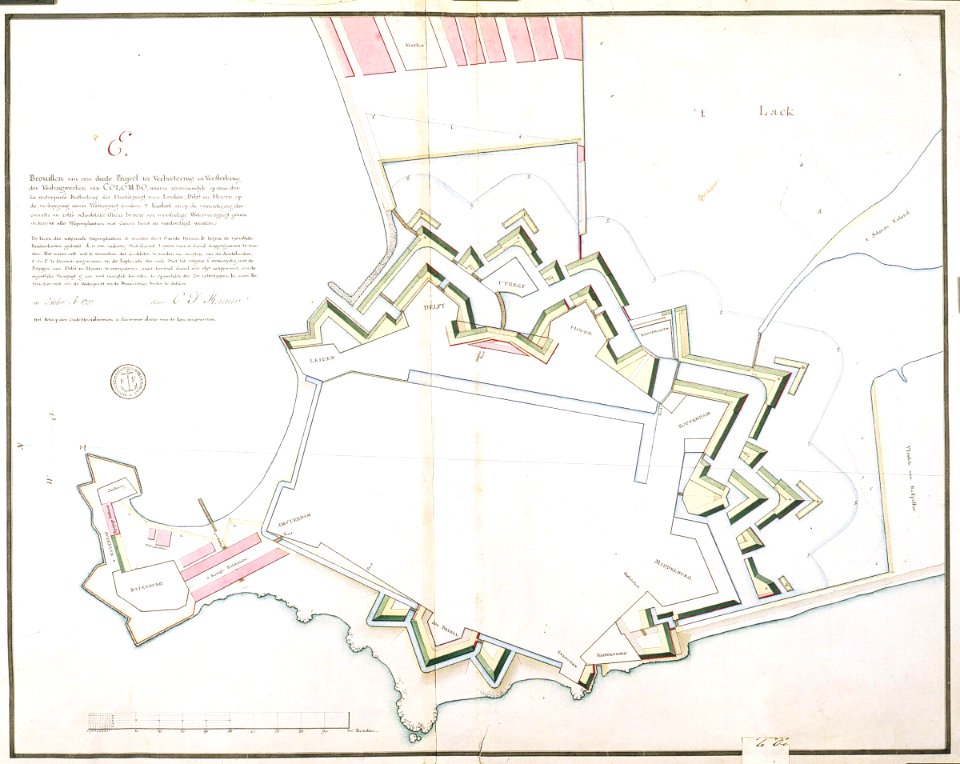
maps from university of amsterdam special collections
atlas der neederlanden
david rumsey historical map collection
1794 maps of the holy roman empire
david rumsey historical map collection
1790s maps of the holy roman empire
didier robert de vaugondy
philippe buache
van langren map of southeast asia
1595 maps of asia
a map of the british empire in america with the french and spanish settlements adjacent thereto
1730s maps of the caribbean
a map of the british empire in america with the french and spanish settlements adjacent thereto
1730s maps of the caribbean
a map of the british empire in america with the french and spanish settlements adjacent thereto
1730s maps of central america
maps by johann baptist homann
sanson maps of the holy land
satirical prints in the british museum
works after robert dighton
satirical prints in the british museum
works after robert dighton
1640s maps of the americas
maps by jodocus hondius
bibliothèque nationale de france
sanson map of lorraine
maps by willem and johannes blaeu
1680s maps of indonesia
maps by willem and johannes blaeu
1680s maps of indonesia
bibliothèque nationale de france
dheulland map of paris
1670s maps of greece
guillaume sanson
maps by pieter mortier
maps from gallica
bibliothèque nationale de france
maps by tomas lopez
maps from gallica
guides joanne
sanson maps of south america
1670s maps of south america
maps of prague by braun & hogenberg
maps of cheb by braun & hogenberg
maps of île-de-france by françois de la guillotière
atlas minor gerardi mercatoris (1621, maps)
maps in the stadsarchief amsterdam
hendrik de leth
john rocque's 1748 map of london and adjacent country
remigius parr
north carolina algonquin
la virginea pars
bibliothèque nationale de france
maps by tomas lopez
maps of the course of the rhine by guillaume sanson
maps by nicolas sanson
buda in the 17th century
baroque
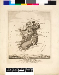
old maps of atlantis
island of california
maps in the stadsarchief amsterdam
claes jansz. visscher (ii)
maps in the stadsarchief amsterdam
claes jansz. visscher (ii)
sanson maps of the holy land
old maps of canaan
johann stridbeck the younger
old maps of the tyrol
jean-fréderic phélypeaux
guillaume dheulland
maps by herman moll
john perry
jean-fréderic phélypeaux
guillaume dheulland
eran laor cartographic collection
claes jansz. visscher (ii)
prints in the royal collection of the united kingdom
thomas vivares
prints by matteo greuter in the statens museum for kunst
copper
maps in the stadsarchief amsterdam
hendrik de leth
andalusia in the 1590s
1590s maps of spain
old maps of lima
joseph mulder
atlas maior, vol 1 (northern europe, norway, and denmark) - joan blaeu, 1667 - bl 114.h(star).1
1667 maps
atlas maior, vol 2 (sweden, russia, poland, eastern europe, and greece) - joan blaeu, 1667 - bl 114.h(star).2
1667 maps of russia
atlas maior, vol 4 (netherlands) - joan blaeu, 1667 - bl 114.h(star).4
1667 maps
media from atlas of mutual heritage on dutch east india company
17th-century maps of mozambique
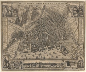
maps from university of amsterdam special collections
atlas der neederlanden
maps in the phoebus foundation
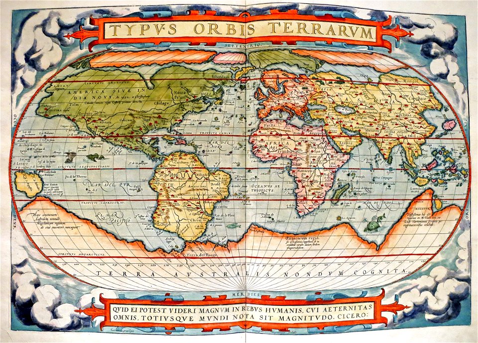
typus orbis terrarum
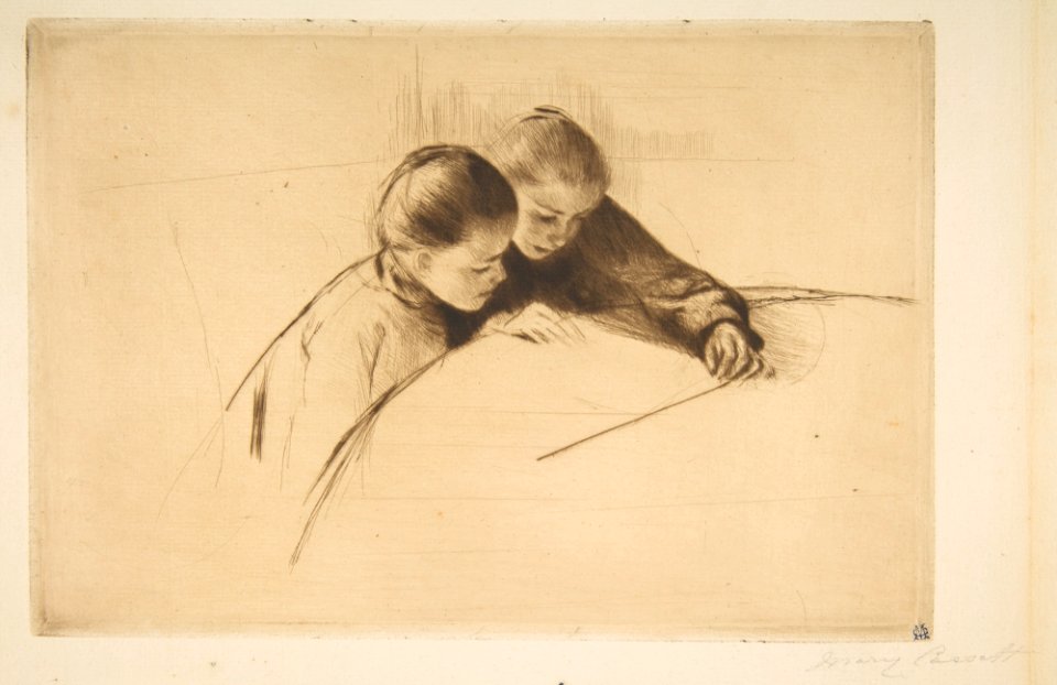
prints by mary cassatt in the metropolitan museum of art
impressionism
beschreibung der städt der welt - braun & hogenberg - btv1b52512111k
maps of orléans by joris hoefnagel
maps made in the 17th century
maps of the duchy of bremen
old maps of norway
guillaume sanson
old maps of norway
guillaume sanson
map of the circle of bavaria by sanson
pierre moullart-sanson
patrimonium 2 (project)
realism
maps from university of amsterdam special collections
atlas der neederlanden
british library - off the map alice collection - wonderland
british library - off the map alice collection
british library - off the map alice collection - wonderland
british library - off the map alice collection
british library - off the map alice collection - wonderland
british library - off the map alice collection
british library - off the map alice collection - wonderland
british library - off the map alice collection
4501 - 4600 of 9,296
Next page
/ 93